I still remember the first time I witnessed a plane land safely using GPS navigation for aircraft. It was during my early days as a design engineer, and I was amazed by the complexity of the system. However, as I delved deeper into the technology, I realized that many people misunderstood how it works. The common myth that GPS navigation is a mysterious, overly complicated process that only experts can grasp has always frustrated me. In reality, understanding how GPS navigation works for aircraft is not only fascinating but also essential for appreciating the science behind safe flights.
As someone who has spent years designing aircraft and explaining complex engineering to the public, I promise to provide you with a clear, hype-free explanation of GPS navigation. In this article, I will walk you through the basics of GPS navigation, explaining how it enables pilots to navigate with precision and accuracy. My goal is to demystify the technology, showing you that the real magic lies in the elegant design and efficient mechanics of GPS navigation systems. By the end of this journey, you will have a deeper understanding of how GPS navigation works for aircraft and a newfound appreciation for the brilliant science that keeps us safe in the sky.
Table of Contents
Decoding Gps Navigation

To truly understand GPS navigation in aircraft, we need to delve into the process of gps signal acquisition. This is the initial step where the aircraft’s GPS receiver detects and locks onto the signals transmitted by GPS satellites. It’s a bit like tuning into your favorite radio station – the receiver needs to find the right frequency to get the signal. Once the signal is acquired, the receiver can then use it to calculate the aircraft’s position, velocity, and time.
The accuracy of GPS navigation relies heavily on the gps receiver sensitivity. A more sensitive receiver can pick up weaker signals, allowing the aircraft to navigate even in areas with limited satellite visibility. This is particularly important for instrument landing systems, where precision is crucial for safe landing. By combining GPS data with other navigation systems, aircraft can ensure a smooth and accurate approach.
In modern aviation, aviation gps software plays a vital role in managing GPS waypoints and routes. This software enables pilots to easily plan and execute complex flight plans, taking into account factors like weather, air traffic, and fuel efficiency. By streamlining gps waypoint management, pilots can focus on flying the aircraft, rather than getting bogged down in navigation details.
Aircraft Navigation Systems Revealed
As we delve into the world of aircraft navigation systems, it’s essential to understand the interplay between technology and flight. This intricate dance is what makes modern aviation so remarkable.
The key to efficient navigation lies in the ability of these systems to process vast amounts of data quickly and accurately, ensuring that pilots can make informed decisions in real-time.
Unlocking Gps Signal Acquisition
To unlock the full potential of GPS navigation, we first need to understand how aircraft acquire the GPS signal. This process begins with the signal transmission from a network of satellites orbiting the Earth. The satellites continuously transmit radio signals, which contain their location and the current time.
The key to successful GPS navigation lies in the aircraft’s ability to decode the signal and use it to determine its own location. This is achieved through sophisticated receivers that can detect and process the weak signals transmitted by the satellites, allowing the aircraft to calculate its precise position, velocity, and time.
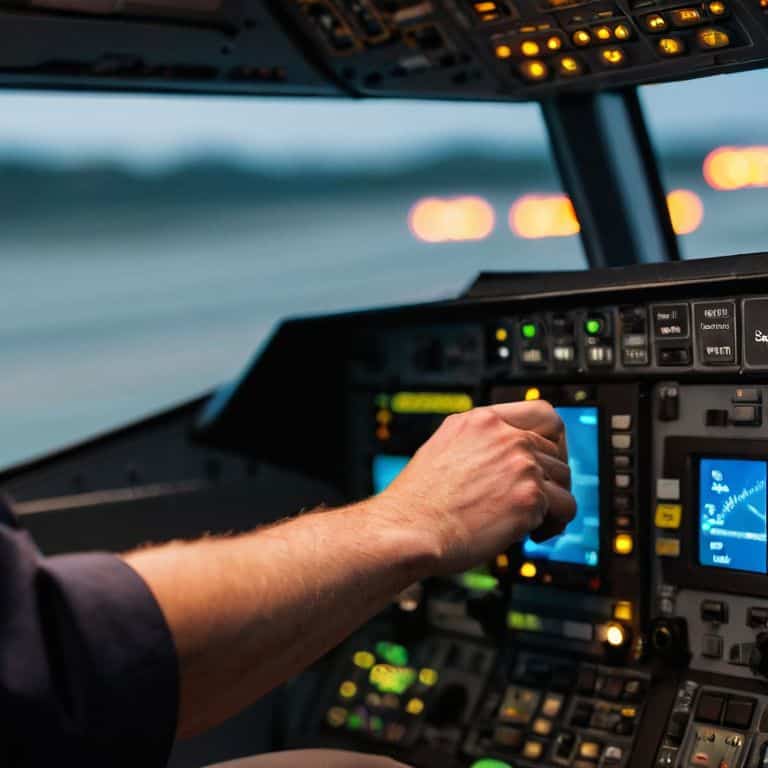
How Gps Navigation Works for Aircraft
As I delve into the world of GPS navigation for aircraft, I’m reminded of the complexity of gps signal acquisition. It’s fascinating to see how these systems work together to provide accurate location information. The process begins with the aircraft’s GPS receiver, which is designed to detect and decode the signals transmitted by a network of satellites orbiting the Earth. This receiver is typically very sensitive, allowing it to pick up weak signals and provide accurate location data even in challenging environments.
The gps waypoint management system is another crucial component of aircraft navigation. This system allows pilots to create and manage a series of waypoints, which are essentially coordinates that the aircraft will follow to reach its destination. By combining GPS data with other navigation systems, such as instrument landing systems, pilots can ensure a safe and efficient journey. I’ve always been impressed by the aviation gps software that powers these systems, as it enables pilots to easily manage complex flight plans and make adjustments on the fly.
In my experience as an aerospace engineer, I’ve seen firsthand the importance of gps receiver sensitivity in aircraft navigation. A high-quality GPS receiver can make all the difference in providing accurate location data, even in areas with limited satellite coverage. By combining advanced GPS technology with other navigation systems, such as instrument landing systems, pilots can ensure a safe and efficient journey. Whether it’s managing waypoints or navigating through challenging weather conditions, GPS navigation plays a critical role in modern aviation.
Mastering Gps Waypoint Management
As pilots navigate through the skies, precise location tracking is crucial for ensuring safe and efficient flight paths. This is where GPS waypoint management comes into play, allowing pilots to pre-program specific coordinates and altitudes for their journey. By doing so, they can focus on other critical aspects of flying, such as monitoring weather conditions and air traffic.
Effective GPS waypoint management involves strategic route planning, taking into account factors like fuel efficiency, air traffic control restrictions, and weather patterns. By mastering this skill, pilots can optimize their flight plans, reducing the risk of errors and improving overall safety.
Optimizing Gps Receiver Sensitivity
As I delve into the intricacies of GPS navigation, I’m reminded of the importance of receiver sensitivity in ensuring accurate location data. This is particularly crucial in aircraft, where precise navigation can be a matter of life and death. By optimizing receiver sensitivity, pilots can rely on their GPS systems to provide accurate information even in areas with limited satellite visibility.
To achieve this, aircraft manufacturers employ various techniques, including the use of high-gain antennas and advanced signal processing algorithms. These technologies enable GPS receivers to detect and decode weak signals, providing pilots with accurate location data even in challenging environments.
5 Essential Insights into Aircraft GPS Navigation

- Understanding Signal Multipath: How surrounding terrain and aircraft structures can affect GPS signal accuracy
- Waypoint Navigation Best Practices: Optimizing flight plans for efficient GPS tracking and reduced signal loss
- Receiver Sensitivity Tuning: Adjusting GPS receiver settings for optimal performance in various flight conditions
- Satellite Geometry and Signal Strength: How the position of GPS satellites impacts signal quality and navigation accuracy
- Integration with Other Navigation Systems: Combining GPS with inertial measurement units and terrain reference systems for enhanced situational awareness
Key Takeaways: Unlocking the Power of GPS Navigation for Aircraft
GPS navigation for aircraft relies on a complex interplay of satellite signals, receiver sensitivity, and onboard systems to provide accurate and reliable positioning data
Mastering GPS waypoint management and optimizing receiver sensitivity are crucial for pilots to navigate efficiently and safely, especially in challenging weather conditions or unfamiliar airspace
By understanding the fundamental principles of GPS signal acquisition, aircraft navigation systems, and waypoint management, pilots and aviation enthusiasts can appreciate the brilliant science behind modern air travel and make more informed decisions in the skies
Unlocking Aviation's Hidden Pattern
The elegance of GPS navigation for aircraft lies not in its complexity, but in its ability to weave together a multitude of simple, yet precise calculations, creating a tapestry of location and direction that guides us safely through the skies.
Simon Foster
Conclusion: Navigating the Skies with Precision
As we’ve explored the intricacies of GPS navigation for aircraft, it’s clear that mastering GPS technology is crucial for safe and efficient flight. From decoding GPS signal acquisition to optimizing GPS receiver sensitivity, each component plays a vital role in ensuring pilots can rely on accurate navigation. By understanding how GPS navigation works for aircraft, we can appreciate the brilliant science that goes into designing these systems. Whether it’s waypoint management or signal processing, every aspect of GPS navigation is a testament to human ingenuity and the pursuit of innovation.
As we conclude our journey into the world of GPS navigation for aircraft, let’s not forget the magic of flight itself. The fact that we can soar through the skies, guided by a complex interplay of technology and science, is a truly awe-inspiring feat. As an aerospace engineer and technical journalist, I hope I’ve inspired you to look up at the planes flying overhead with a newfound appreciation for the elegant design and precision engineering that makes it all possible. The next time you board a flight, remember the incredible technology that’s working behind the scenes to get you safely to your destination.
Frequently Asked Questions
How do aircraft GPS systems handle signal interference or loss of signal in areas with heavy tree cover or between tall buildings?
When flying in areas with heavy tree cover or between tall buildings, aircraft GPS systems can experience signal interference or loss. To mitigate this, pilots use a combination of GPS and other navigation aids, such as inertial measurement units or terrain-reference systems, to ensure continued navigation. Additionally, some GPS systems employ signal augmentation technologies to improve reception in challenging environments.
What is the typical accuracy of GPS navigation in aircraft, and how does it compare to other navigation methods?
The typical accuracy of GPS navigation in aircraft is around 3-5 meters, which is remarkably precise. Compared to other methods like VOR or NDB, GPS is significantly more accurate and reliable, making it the gold standard for modern aviation navigation.
Can aircraft GPS systems be hacked or compromised, and what security measures are in place to prevent such incidents?
As an aerospace engineer, I can assure you that aircraft GPS systems have robust security measures in place, such as encryption and secure authentication protocols, to prevent hacking and compromise. Additionally, GPS signals are continuously monitored for integrity and authenticity to ensure safe and reliable navigation.